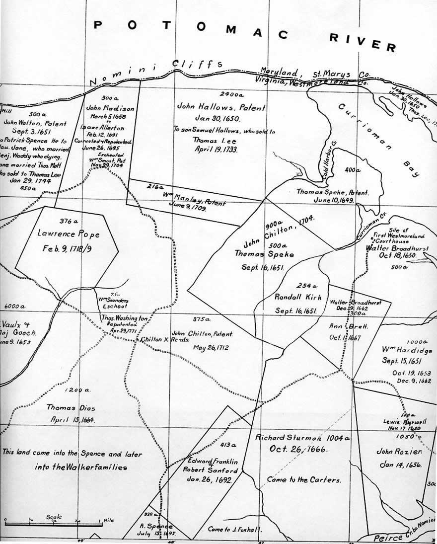
William Hardidge and Richard Sturman Westmoreland County, Land Patents
This map shows the 1651 and 1653 land patents of William Hardidge near the right lower margin. Richard Sturman's land is just to the left. From David W. Eaton, "Historical Atlas of Westmoreland County" (Dietz Press, Richmond, 1942), Patents Sheet 9, page 67. [124]
To Top